
Buy a Complete Kit
Own a complete field-ready RTK kit configured and tested before handover. Select MADIX RTK Network access for the required period when coverage is available at your project location.
MADIX COMPLETE RTK ROVER KIT
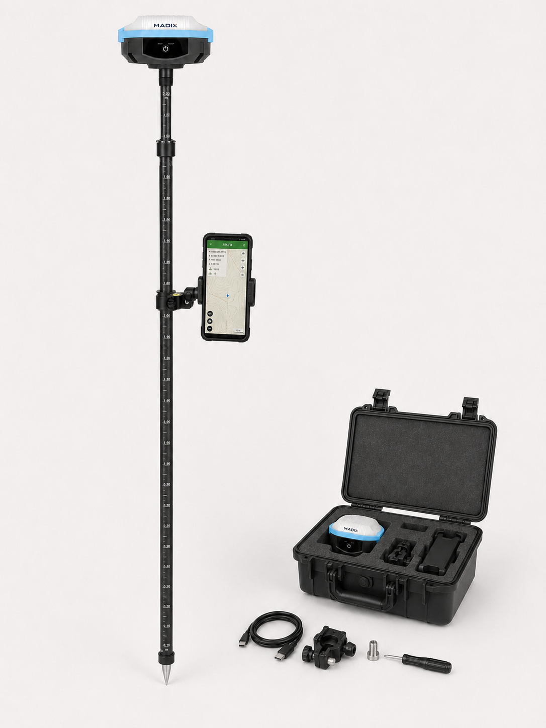
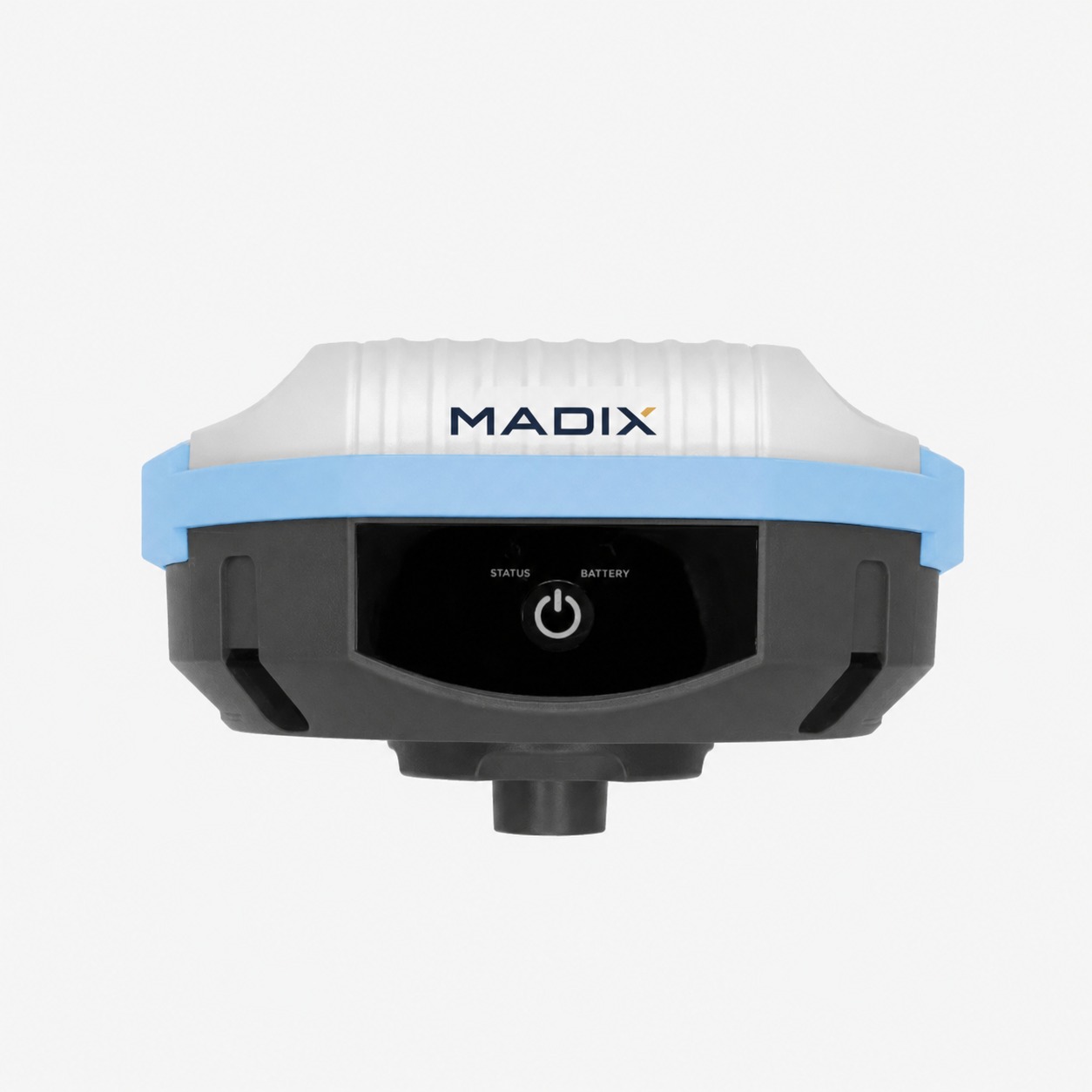
Measure and set out with centimeter-level RTK positioning in confirmed MADIX coverage areas—without installing a local base station. The complete kit includes the MADIX Smart RTK Rover, professional survey pole, pole-mounted device holder, configured Android field device, transport case, initial configuration and onboarding.
Pricing is confirmed after a free coverage and configuration check. A written quotation will identify the exact equipment, services and commercial terms included.
Commercial options
Quotation-based pricing — Final pricing depends on the selected hardware, network-access period, project location, training, delivery and commercial terms.
Own a complete field-ready RTK kit configured and tested before handover. Select MADIX RTK Network access for the required period when coverage is available at your project location.
Rent a configured complete kit by day, week, month or project. The written quotation will specify the approved rental period, network access, deposit, delivery or collection and support terms.
Equip multiple crews with configured rover kits, managed NTRIP accounts, team onboarding and project-specific technical support.
What is included
The exact survey-pole and Android-device models are identified in the written quotation before supply. Network access, software licences, training, delivery, optional bipod, power accessories and other add-ons are included only when explicitly stated in the quotation.
Comparison
| Item | Rover only | Complete kit purchase | Complete kit rental | Multi-kit project package |
|---|---|---|---|---|
| RTK rover | Included | Included | Included | Included |
| Survey pole | Not included | Included | Included | Included |
| Android field device | Not included | Included | Included | Included |
| Transport case | Optional | Included | Included | Included |
| Configuration and test | Included | Included | Included | Included |
| Network access | Optional | Optional | Per quotation | Per quotation |
| Onboarding | Optional | Included | Included | Included |
| Multi-user / project support | Not included | Optional | Optional | Included |
| Ownership | Customer | Customer | MADIX | Per quotation |
| Rental period | Not included | Not included | Day, week, month or project | Project duration |
| Quotation required | Yes | Yes | Yes | Yes |
How it works
Send the project location or coordinates so MADIX can confirm RTK Network availability.
Select purchase, rental or a multi-kit project configuration.
MADIX configures the rover, field device, application and NTRIP connection, then verifies the workflow before handover.
Service is currently available within supported areas of Damascus, Rif Damascus and Homs, with phased network expansion underway.
Specifications
| GNSS engine | u-blox ZED-F9P |
|---|---|
| Signals tracked | Multi-band, multi-constellation GNSS receiver supporting GPS L1C/A and L2C; GLONASS L1OF and L2OF; Galileo E1-B/C and E5b; BeiDou B1I and B2I; QZSS L1C/A and L2C; and supported SBAS signals. |
| Correction data reception | NTRIP mountpoint over the configured field workflow, using a compatible RTCM configuration |
| Positioning modes | RTK rover, GNSS base station and PPK data collection |
| Interfaces | USB-C, Bluetooth and BLE |
| Pole connection | Standard 5/8-inch × 11 TPI |
| Receiver protection | IP65 for the RTK smart antenna unit |
| Integrated battery | More than 12 hours under manufacturer-stated conditions |
Antenna hardware coverage does not mean that the installed receiver tracks every supported antenna band.
Centimeter-level positioning may be achieved under suitable satellite visibility, correction quality, communication, receiver configuration and site conditions. Actual performance must be assessed for the intended workflow and location.
| GNSS engine | u-blox ZED-F9P |
|---|---|
| Receiver type | Professional dual-band multi-constellation RTK GNSS receiver |
| Receiver frequencies | L1 and L2, including the supported Galileo E5b signal configuration |
| Integrated antenna | Survey-grade antenna hardware covering L1, L2, L5, L6 and L-Band |
| Positioning modes | RTK rover, GNSS base station and PPK data collection |
| Correction delivery | NTRIP through a connected mobile device or compatible internet workflow |
| Correction format | Compatible RTCM configuration according to receiver and service setup |
| Raw data | UBX raw GNSS data output |
| Default update rate | 1 Hz |
| Configurable update rate | Up to 10 Hz at maximum stated performance; higher modes may reduce performance |
| First position fix | Approximately 25 seconds cold start and 2 seconds hot start under manufacturer test conditions |
| First RTK fix | Approximately 35 seconds from cold start under manufacturer test conditions |
| Satellite systems | GPS, GLONASS, Galileo, BeiDou, QZSS and supported SBAS systems |
| Rover / base support | Yes |
| PPK support | Yes |
The installed receiver is a dual-band configuration and is not described as a triple-band or full-band receiver. The physical antenna hardware covers a wider frequency range than the installed receiver; these specifications are stated separately on purpose.
| USB | USB-C |
|---|---|
| Bluetooth | Included |
| Bluetooth Low Energy | Included |
| Wi-Fi hardware | Present but currently disabled in the standard configuration |
| Android connection | USB or Bluetooth with compatible applications |
| iOS connection | Bluetooth Low Energy; currently documented for SW Maps |
| Windows connection | USB or Bluetooth |
| Linux connection | USB or Bluetooth |
| Internal 4G modem | Not included in the standard configuration |
| Mobile internet | Supplied through the included Android device, SIM or another validated connection method |
| Receiver weight | Approximately 725 g |
|---|---|
| Receiver protection | IP65 |
| Transport-case protection | IP67 |
| Pole connection | Standard 5/8-inch × 11 TPI |
| Power and charging | USB |
| Integrated battery | More than 12 hours under manufacturer-stated conditions |
| Operating-temperature range | −40°C to +85°C for the receiver electronics under the manufacturer's stated specification |
| Certifications and documentation | CE, RED and RoHS documentation, subject to the white-label product documentation supplied to MADIX |
Environmental ratings apply to the stated component only. The mobile device and accessories do not share the rover's environmental rating.
| Receiver module temperature | −40°C to +85°C, as stated by the GNSS module manufacturer for the module itself |
|---|---|
| Complete rover operating temperature | Confirmed in the written quotation; the module range is not transferred to the assembled rover |
| Charging temperature | Confirmed in the written quotation |
| Storage temperature | Confirmed in the written quotation |
| Android-device limits | As published by the supplied device manufacturer; the device does not share the rover's protection rating |
Commercial terms are confirmed in the written quotation or agreement for each supply.
Notes
Applications
Topographic survey, control checks and setting out from project coordinates.
Axes, foundations, columns and level verification on building sites.
Alignment staking, cross-sections and progress checks for earthworks.
As-built capture of networks and attribute collection for GIS databases.
Measurement of ground control and check points for photogrammetric projects.
Independent verification of executed works against design data.
Machine-control corrections and integrations require a separate compatible system and project assessment.
FAQ
The MADIX Smart RTK rover, professional survey pole, pole-mounted device holder, configured Android field device with protective case, fitted transport case, USB-C cable and approved charging accessories, pole clamp and thread adapter, a selected compatible field application, initial NTRIP configuration and connection test, a quick-start guide and remote onboarding. Exact models are listed in the written quotation.
Yes. Complete kits are available by day, week, month or for the project duration, subject to availability. The rental period, network access, security deposit and delivery or collection terms are stated in the quotation and rental agreement.
Access to the MADIX RTK Network is included only when the quotation states it, and only after coverage is confirmed for the project location. The access period is defined commercially and can be extended.
MADIX supplies a field device that meets the required Android version, screen visibility, battery endurance and connectivity for the selected application. The exact brand and model are identified in the written quotation before supply.
No. The supplied rover does not provide tilt compensation unless a quotation explicitly identifies a tilt-capable receiver. The pole must be levelled for every measurement.
Yes. Correction data reception over an NTRIP mountpoint requires a reliable internet connection through the configured field workflow. A SIM card and mobile-data plan are not included unless explicitly stated.
Centimeter-level positioning may be achieved under suitable satellite visibility, correction quality, communication, receiver configuration and site conditions. Actual performance must be assessed for the intended workflow and location.
Coverage is confirmed per project location before supply. Send the location or coordinates and MADIX will confirm whether RTK Network service is available there.
The rover works with common Android field applications that support an NTRIP client and a compatible RTCM configuration. The selected application is confirmed with you before configuration, together with the coordinate-system requirements.
Support scope, warranty and service terms are defined in the written quotation or agreement for each supply. MADIX does not publish standard warranty, return or replacement periods on this page.
Pricing is confirmed after a free coverage and configuration check. A written quotation will identify the exact equipment, services and commercial terms included.
Service is currently available within supported areas of Damascus, Rif Damascus and Homs, with phased network expansion underway.